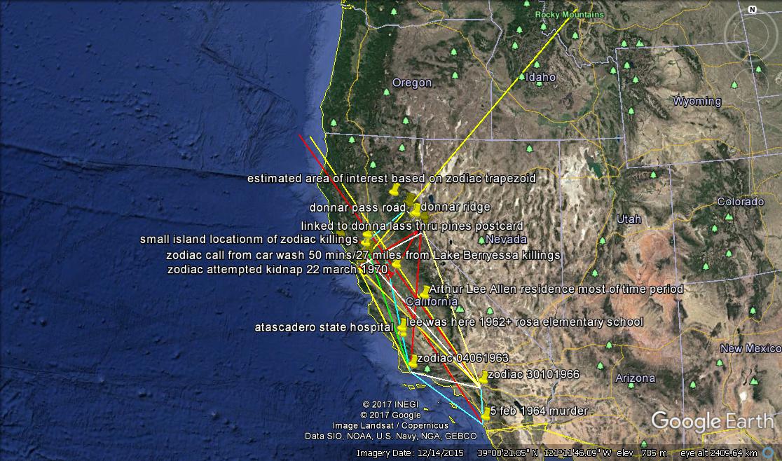
I have been using Google Earth for mapping out elements within the Zodiac case, and am just trying to upload an image of what I have so far. (This is a tester, so apologies if any cock-ups.)
Note the general trapezoid shape which seems to be a regularly mentioned pattern, and for arguments sake can be called Zodiac’s killing zone.
This also considers that:
The double murders of 1963/64 and Riverside are attributed to Zodiac as some evidences may suggest.
That Donna Lass is his 13th victim, with the previous 12 being his body count regardless of whether the victim(s) survived- as a hunter he did his bit in terms of thinking he had performed his ‘finishing off prey’.
That Allen resided near the centre of the killing zone.
That there are patterns, which become obvious when Google Earth is treated like a map such as Zodiac’s 66 one.
This is still a work in progress so any hints or corrections are welcomed, as some exact locations aren’t exact enough I feel, so further information would be welcomed.
Also, the marking out of lake Gold north of Lake Talahoe is something I am looking into; in particular, does anyone know of any Zodiac suspects who had access to a private lake -or owned a private lake- near Lake Gold northwest of Lake Tahoe? Or it could even be Gold mountain or that region, but private lake is definitely relevant.
Any pointers would be appreciated.