
Why at this time, in June 1970, did Zodiac reference Mt. Diablo on the map?
Found this interesting, at that time, there was some earthquake research going on there-
http://books.google.com/books?id=T0ArAA … 22&f=false
There is more than one way to lose your life to a killer
http://www.zodiackillersite.com/
http://zodiackillersite.blogspot.com/
https://twitter.com/Morf13ZKS
Or this seems like a possible reason too-actually,really interesting!
from the 6/24/70 Oakland Tribune-
"WALNUT CREEK Mt. Diablo Amateur Radio Club will base a crew and "emergency" equipment… …on top of Mt. Diablo Saturday and Sunday to participate in the nationwide Field Day…"
Two days before Zodiac mailed this map mentioning Mt Diablo, this article is printed…what timing. Was Z part of that club??
There is more than one way to lose your life to a killer
http://www.zodiackillersite.com/
http://zodiackillersite.blogspot.com/
https://twitter.com/Morf13ZKS

The club still exists. You could ask them if they have membership records for that time period. I am almost certain they do.
13-Zebra-5, John Frank William eight nine nine.
11-Mary-6, call the station.
The club still exists. You could ask them if they have membership records for that time period. I am almost certain they do.
Yeah, that is in the works
There is more than one way to lose your life to a killer
http://www.zodiackillersite.com/
http://zodiackillersite.blogspot.com/
https://twitter.com/Morf13ZKS

Or this seems like a possible reason too-actually,really interesting!
from the 6/24/70 Oakland Tribune-
"WALNUT CREEK Mt. Diablo Amateur Radio Club will base a crew and "emergency" equipment… …on top of Mt. Diablo Saturday and Sunday to participate in the nationwide Field Day…"Two days before Zodiac mailed this map mentioning Mt Diablo, this article is printed…what timing. Was Z part of that club??
It wouldn’t surprise me at all if he was.
Add that to what Mt. Diablo was used for…mapping longitude and latitude (the Phillips 66 map)…I think Zodiac was quite familiar with Mt. Diablo and it’s uses.

“…they may be dealing with one or more ersatz Zodiacs–other psychotics eager to get into the act, or perhaps even other murderers eager to lay their crimes at the real Zodiac’s doorstep.“ L.A. Times, 1969
There’s even a chance that more than one person out there in the world has an old QSL card from Zodiac. I’ll admit that I view many of the models and scenarios proposed here and in other fora with an eye jaundiced by many years of experience wielding Bill of Ockham’s blade, finding that most things are more simple and direct than our human imaginations make them out to be, but involvement in amateur radio would be right in line with other things known and legitimately inferred about Zodiac, and the connection to Mt. Diablo would, considering other variables, fall in line with that. This is one line of inquiry even I can take seriously. I used the word "line" too many times, but you get the gist.
13-Zebra-5, John Frank William eight nine nine.
11-Mary-6, call the station.
Now,if only somebody could come up with more info on that club, old newsletters,rosters,etc…photos,,etc. Also, there may be records of licensed radio operators out there archived someplace.
There is more than one way to lose your life to a killer
http://www.zodiackillersite.com/
http://zodiackillersite.blogspot.com/
https://twitter.com/Morf13ZKS
Plenty of people to contact here:
http://www.mdarc.org/board.html
Probably would work best if done by someone who’s a licensed ham.
13-Zebra-5, John Frank William eight nine nine.
11-Mary-6, call the station.
I’m sure you guys already have all this, but just in case, here’s a Yahoo! group for the club:
http://groups.yahoo.com/neo/groups/mdarc/info?tab=s
13-Zebra-5, John Frank William eight nine nine.
11-Mary-6, call the station.
Have put some requests out there for info or assistance from this club,but so far,no response
There is more than one way to lose your life to a killer
http://www.zodiackillersite.com/
http://zodiackillersite.blogspot.com/
https://twitter.com/Morf13ZKS
Morf,
You seem to be looking for possible ideas as to why the Zodiac chose Mt. Diablo and have offered two suggestions: earthquake research and amateur radio. Havent heard of the earthquake research until now. You know how I feel about amateur radio. I have offered info on the subject in the past.
May I offer a new take?
Just recently i was looking into aerial/radio navigation as it may relate to the Phillips 66 map. I decided to look at Mt. Diablo again but with eyes on aerial/radio navigation. I learned that, on the spot where the octogonal rotunda and compass is presently located, once stood a Standard Oil tower and beacon. It was one of two towers that was erected in 1928 for the purpose of guiding pilots during night time commercial air travel. The companion tower is located in Merced Hills, California. As stated, both towers were for the purpose of guiding commercial airflight at night. The main or predominate commercial flights on the minds of Standard Oil and the Department of Commerce, who funded the towers, was airrmail delivery for the U.S. Postal Service.
Personally, given the Zodiac’s use of "AIR MAIL", I find the Standard Oil tower to be of some significance.
Additionally, and on a separate note, I found a newspaper article concerning an airmail plane that had crashed in 1934. The paper was the Idaho Evening Times and was dated March 10, 1934. I believe the crash occurred the day before in Cheyenne, Wyoming. What I found interesting, if nothing more, is the fact that one of the pilots killed was from Riverside, California. His name was A. R. Kerwin and he was a pilot for March Field.
Another point to make, in conjunction with this newspaper article, is that the Zodiac mailed his " air mail" letter on March 13th. Not the same day, obviously but, pretty darn close. I wonder if there is something more on this particular crash or on Kerwin that occurred on March 13th?
Soze
Interesting stuff Soze
There is more than one way to lose your life to a killer
http://www.zodiackillersite.com/
http://zodiackillersite.blogspot.com/
https://twitter.com/Morf13ZKS
This is the only Guy I could find that may be the killed pilot-
http://www.findagrave.com/cgi-bin/fg.cg … 5&ref=acom
There is more than one way to lose your life to a killer
http://www.zodiackillersite.com/
http://zodiackillersite.blogspot.com/
https://twitter.com/Morf13ZKS
I posted about another crash at the zk.com mb—it was April 8, 1946: http://zodiackiller.fr.yuku.com/reply/4 … eply-42835
***
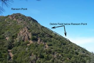
Could Zodiac have been referring to this plane crash site? 2 pilots crashed into Mt. Diablo in 1946.
I like this part: "The Army sent two rescue parties, along with an oil worker from Martinez who heard about the crash". –I wonder why an oil worker?
It mentions: "..the Civil Air Patrol used this crash site to train its cadets and searchers in techniques to reach a crash site".
The site was never cleaned up, but "dynamited".
It appears that up until 2003, there was still wreckage at the location.
DETAILS OF THE CRASH: http://www.check-six.com/Crash_Sites/Di … h_site.htm
*
I still believe since Zodiac was trying to pinpoint a location, Mt. Diablo was simply the place to do it since that is what it was used for. ![]()
http://www.mdshs.org/article.html
*
“…they may be dealing with one or more ersatz Zodiacs–other psychotics eager to get into the act, or perhaps even other murderers eager to lay their crimes at the real Zodiac’s doorstep.“ L.A. Times, 1969
Tahoe,
I don’t want you to take this the wrong way. I love your idea on latitude and longitude. In fact, I believe you to be correct in that latitude and longitude coordinates are necessary in solving the Phillips 66 cipher and, wish that more people would be on board with it. I will be posting in the thread you created on the subject shortly.
But Tahoe, Leander Ransom’s Meridian and Base Lines are on Mt. Diablo Peak and not, the North Peak, which is the location the Zodiac chose on the Phillips 66 map. If you go to the site link you provided you will see the map that B. D. Cuts drew a year after Ransom had been there. Cutts marked out the location of Ransom’s initial point, the location for Ransom’s Meridian/Base lines and the location of Cutts survey location. The description and map is a bit confusing at first. It had me going and believing that I may have been wrong. But I just so happen to have a PDF entitled "Geology and the Mineral Deposits of Mount Diablo" that I was using at one point in my study regarding Geology and the Geological Survey. Towards the end of this PDF, page 39, you will find a detailed map of Mount Diablo and the North Peak. This map was from 1953 and shows a magnetic declination of 17-1/2 degrees. The map clearly shows the Meridian and Base Lines to he on Mt. Diablo Peak.
Now if you go back and look at Cutts drawing, you see the Meridian/Base line point that Ransome had designated is to the far left of the drawing and is described to he 12 miles southwest of Ransom’s initial point. Ransom’s initial point is to the tar right and center. Cutts location for surveying and, the now location of the octogonal rotunda, is bottom right. Cutts map is positioned wrong on this site. It should be rotated 90 degrees counter clockwise.
I do have something to add regarding the plane flight of 1946 and how it may relate to Standard Oil, the Postal Service and airmail but I have somewhere to be shortly and won’t have time to write something up on the subject. That will have to wait.
Soze
