
I was looking at some pictures where the "new bomb scheme" from the My Name Is -letter had been aligned with the Mt. Diablo map. Then noticed that the alignment through San Francisco seems forced, the line doesn’t really seem to follow the roadways. However, if you place the drawing over the other side of the bay, it looks like a much better match. Almost a perfect one, I’d say. I think the scan of the scematic might be a little skewed – I did not alter its proportions.
I don’t know what it means, and I bet it probably has been noted before. But, if anything, I would be inclided to think that Zodiac very well may have had some kind of light table system that made it easy to trace things.
The cross hair in the upper portion of the scheme gets placed pretty much over Lake Herman Rd scene. The one in the lower portion in Hayward. Did anything ever happen in Hayward?

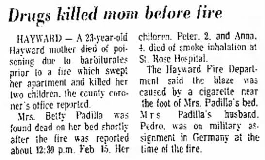
Did some checking at Newspapers.com. On 15th February 1970 three people – Betty Padilla and her two children died in a fire at an apartment at 26369 Gading Rd in Hayward. This adress is pretty much at the same spot where the cross hair points. In the autopsy Betty was deemed to have died over barbiturate overdose prior to the fire. If I looked correctly, in the Dripping Pen card from Oct ’69 Zodiac claimed 7 victims. The next time he wrote down the count was in the My Name Is letter from 20th April ’70, the number now being three more, 10.
A couple of news articles:
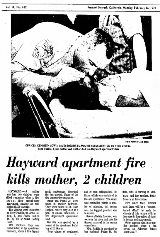
The Argus
Fremont, California
Mon, Feb 16, 1970
The Argus
Fremont, California
Sat, Mar 7, 1970
But, if anything, I would be inclided to think that Zodiac very well may have had some kind of light table system that made it easy to trace things.
Something like this?
*big image*
a college professor would surely have easy access to one…
I was thinking something along the lines of this:

I looked up how the different markings on the schematic coincide with points in the map. The quality isn’t that great but it is what it is.
Lots of elementary schools surrounding the markings. And schools mean school busses. Many of the schools have already been there in the 60s.
Markings "A":


Markings "B":


There seems to be a particularly good bomb planting hill by the road near the Palomares Elementary School.

Looked where the Z-crosshair lands at. There are a couple of ranches there.

bump.
Yes, dyslexia is probably my first undiagnosed language.